

- Main
- Technologies
- Geonaft Software
- Geosteering modules
- Geosteering module
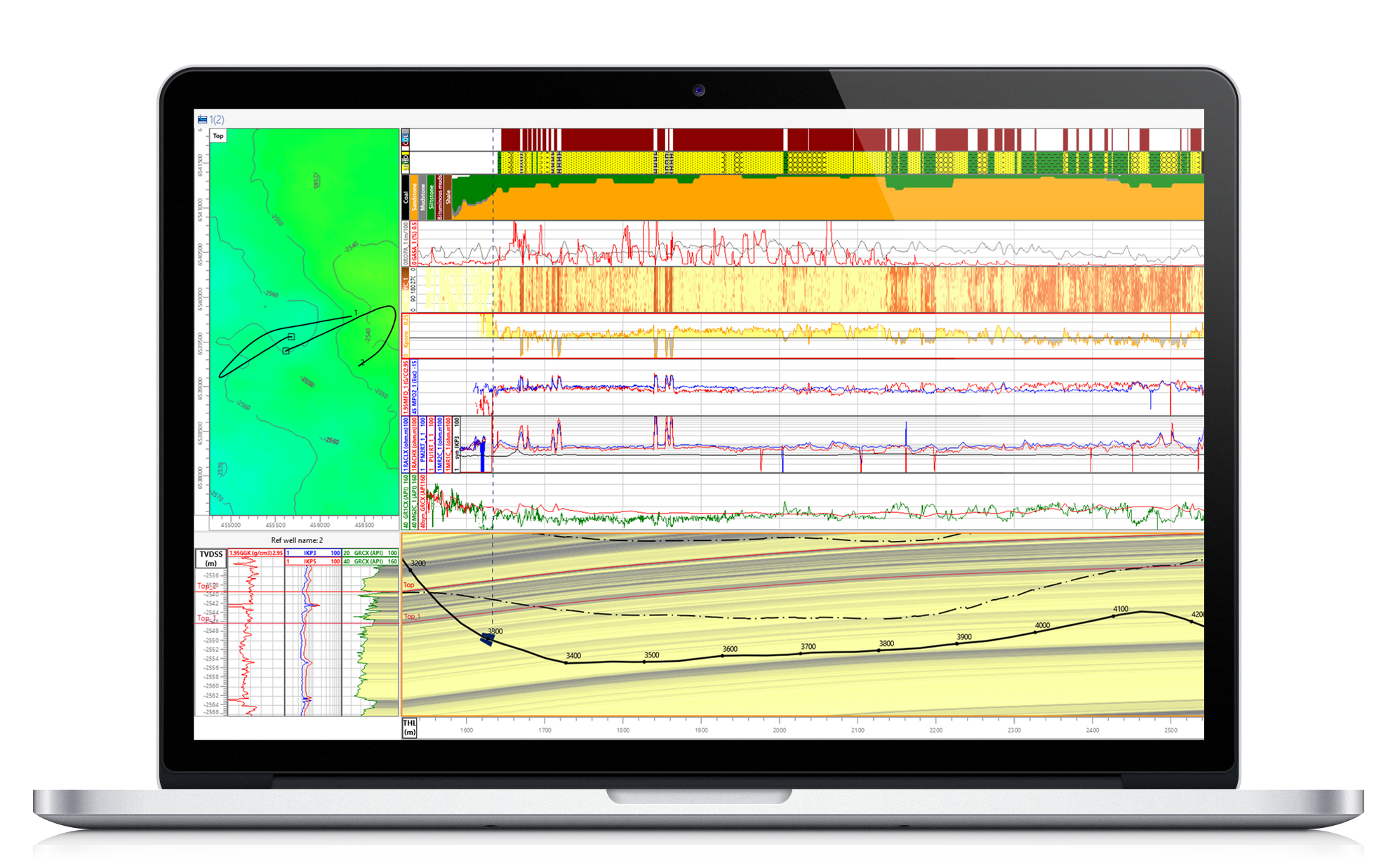
The Geosteering module is based on the method of comparing the synthetic and actual logging. A distinctive feature of the method is the possibility of geosteering both with the help of azimuthal images and a bed boundary detection service, and in the presence of only one gamma-ray log curve.
Solutions:
- Construction of calculated (synthetic) logs based on a 2-dimensional reservoir model taking into account the well trajectory, structural bends of the formation, lateral heterogeneities of the thicknesses of the layers.
- Determining the stratigraphic position of the wellbore in the formation, as well as predicting the behavior of the structure of the formation based on its regional angle of incidence and the selection of actual and synthetic logs.
- Visualization and correction of the drilling trajectory.
Features:
- The construction of a 2-dimensional model of the reservoir
- Calculation of synthetic logging along the trajectory of a drilling well
- Comparison of actual logging during drilling with synthetic logging
- Update of the model, forecast of the structural angle of the formation
- The presence of a two-dimensional structural map
- Modeling of pinchouts, lenses, faults and changes in thickness
- Modeling the responses of logging tools
- Work with structural surfaces both on a 2D map, and as lines of intersection of surfaces and a geosteering cross- section
- Display of well design elements and corrections of the trajectories on the geosteering cross – section.
- Automatic generation of reports based on the results of the work