

- Main
- Technologies
- Geonaft Software
- Geosteering modules
- Azimuth data interpretation module
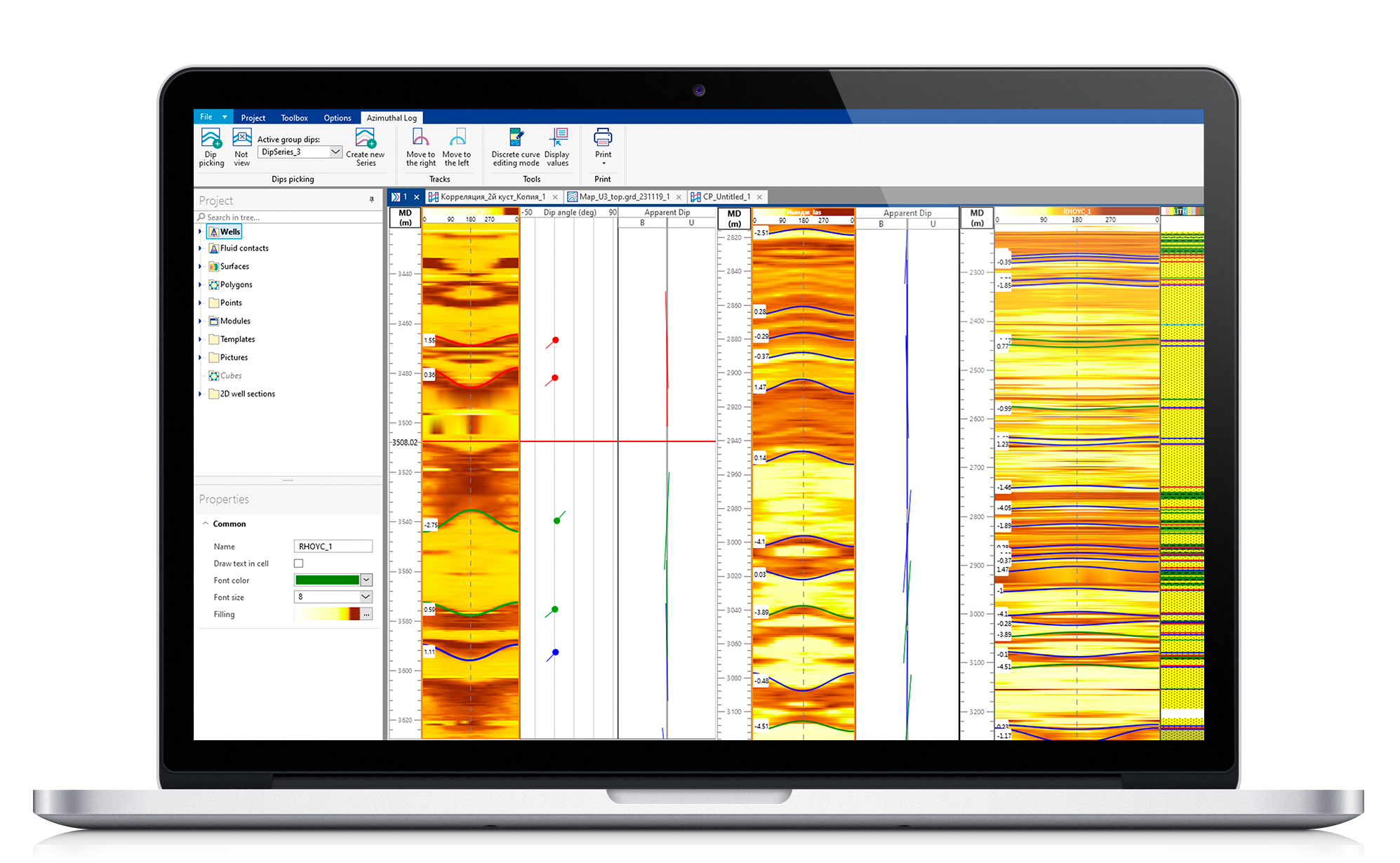
Using only traditional logging while drilling for geosteering is difficult, since such logging does not provide an azimuthal direction of measurements in the well. As a result of this, changes in lithology can be interpreted as drilling up the formation and down the formation.
Solutions:
- Analysis and construction of a geosteering model based on the results of the most modern methods of well logging (Borehole Images).
- Precise determination of the direction of drilling of the wellbore in the formation.
- The ability to interpret azimuthal data allows us to obtain the information necessary to determine the direction in which the wellbore crosses geological formations.
- Minimizing the cost of geosteering, using only azimuthal quadrant data.
- The module allows you to obtain the information necessary to determine the direction in which the wellbore crosses geological formations, and then determine the exact direction of the path of the wellbore in the reservoir.
Features:
In the Azimuth Data Interpretation module provides the possibility to calculate the inclination of the formation angle in two different ways:
- Using wellbore image data
- Using quadrant azimuth data
The user has the opportunity to carry out the calculation separately for each of the methods or using both at the same time.